
Ver3.5 🗺️ iOS 위치 서비스와 Core Location · MapKit으로 만드는 LBS 앱 개발 가이드
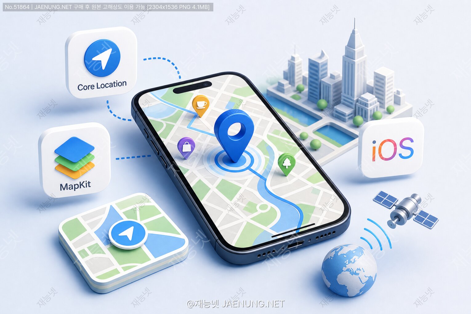
🗺️ iOS 위치 서비스와 Core Location · MapKit으로 만드는 LBS 앱 개발 가이드
Core Location부터 MapKit 커스터마이징까지, 실전 LBS 앱 개발의 모든 흐름을 파헤쳐보자!
야 솔직히 말해서 📍 위치 기반 앱(LBS, Location-Based Service)은 이제 그냥 "있으면 좋은 기능"이 아니라 없으면 앱이 반쪽짜리가 되는 시대잖아ㅋㅋ 배달 앱, 카카오맵, 당근마켓, 심지어 피트니스 앱까지 전부 위치 정보를 기반으로 돌아가고 있으니까. 그래서 오늘은 iOS에서 위치 서비스를 구현하는 핵심 프레임워크인 Core Location과 MapKit을 제대로 뜯어보려고 해!
C 언어 기반의 저수준 API부터 Swift로 감싸진 고수준 인터페이스까지, 실제로 앱에서 어떻게 동작하는지 코드랑 개념을 같이 보면서 가보자고~ 🚀
📡 1. LBS 앱이란? 위치 기반 서비스의 세계
LBS(Location-Based Service)는 말 그대로 사용자의 현재 위치 정보를 기반으로 서비스를 제공하는 앱이야. 우리가 매일 쓰는 앱들 대부분이 여기에 해당해ㅋㅋ
🍕 배달 앱 🗺️ 내비게이션 🏃 러닝 트래커 🛒 근처 가게 찾기
🚗 카풀/택시 📸 위치 태그 사진 🎮 AR 게임 🏥 응급 서비스
이 모든 앱들이 iOS에서 Core Location과 MapKit을 기반으로 동작해!
iOS에서 위치 서비스를 구현하는 데 쓰이는 핵심 프레임워크는 크게 두 가지야:
Core Location은 위치 데이터 수집에 집중하고, MapKit은 지도 시각화에 집중해. 둘은 독립적으로도 쓸 수 있어 — 지도 없이 위치만 추적하거나, 위치 추적 없이 정적인 지도만 보여줄 수도 있거든!
🔵 2. Core Location 프레임워크 파헤치기
2-1. CLLocationManager — 위치 서비스의 심장
CLLocationManager는 Core Location의 핵심 클래스야. 이 친구가 없으면 위치 서비스 자체가 불가능해ㅋㅋ 얘를 통해서 권한 요청, 위치 업데이트 시작/중지, 지오펜싱 설정 등 모든 걸 제어해.
import CoreLocation

class LocationManager: NSObject, CLLocationManagerDelegate {

    // CLLocationManager 인스턴스 생성
    private let locationManager = CLLocationManager()

    override init() {
        super.init()
        // 델리게이트 설정 - 위치 업데이트를 받을 객체 지정
        locationManager.delegate = self
        // 위치 정확도 설정 (배터리 vs 정밀도 트레이드오프)
        locationManager.desiredAccuracy = kCLLocationAccuracyBest
        // 최소 이동 거리 설정 (미터 단위) - 이 거리 이상 움직여야 업데이트
        locationManager.distanceFilter = 10.0
    }

    // 위치 권한 요청
    func requestPermission() {
        locationManager.requestWhenInUseAuthorization()
    }

    // 위치 업데이트 시작
    func startUpdating() {
        locationManager.startUpdatingLocation()
    }

    // 위치 업데이트 중지
    func stopUpdating() {
        locationManager.stopUpdatingLocation()
    }
}
2-2. 위치 권한 — 이게 제일 중요해!
iOS에서 위치 서비스를 쓰려면 반드시 사용자에게 권한을 요청해야 해. 애플이 프라이버시에 엄청 엄격하거든ㅋㅋ 권한 종류는 크게 세 가지야:
| 권한 종류 | 설명 | 사용 시나리오 |
|---|---|---|
| When In Use | 앱이 포그라운드에 있을 때만 위치 접근 | 지도 앱, 음식 주문 |
| Always | 백그라운드에서도 위치 접근 가능 | 러닝 트래커, 지오펜싱 |
| Denied/Restricted | 사용자가 거부하거나 시스템 제한 | 설정 앱으로 유도 필요 |
권한 요청 전에 반드시
Info.plist에 사용 목적 문자열을 추가해야 해. 없으면 앱이 크래시나거나 앱스토어 심사에서 리젝당해!NSLocationWhenInUseUsageDescription — "앱 사용 중 위치 접근 이유"NSLocationAlwaysAndWhenInUseUsageDescription — "항상 위치 접근 이유"NSLocationAlwaysUsageDescription — iOS 10 이하 호환용
// 권한 상태 변화 감지 (iOS 14+)
func locationManagerDidChangeAuthorization(_ manager: CLLocationManager) {
    switch manager.authorizationStatus {
    case .notDetermined:
        // 아직 결정 안 됨 - 권한 요청
        manager.requestWhenInUseAuthorization()
    case .authorizedWhenInUse:
        // 앱 사용 중 허용 - 위치 업데이트 시작 가능
        manager.startUpdatingLocation()
    case .authorizedAlways:
        // 항상 허용 - 백그라운드 위치도 가능
        manager.startUpdatingLocation()
    case .denied:
        // 거부됨 - 설정 앱으로 유도
        print("위치 권한이 거부되었습니다. 설정에서 변경해주세요.")
    case .restricted:
        // 시스템 제한 (자녀 보호 등)
        print("위치 서비스가 제한되어 있습니다.")
    @unknown default:
        break
    }
}
2-3. CLLocation — 위치 데이터 객체
CLLocation은 실제 위치 정보를 담는 객체야. 단순히 위도/경도만 있는 게 아니라 엄청 많은 정보를 포함하고 있어:
coordinate.latitude 위도 (-90 ~ 90)
coordinate.longitude 경도 (-180 ~ 180)
altitude 고도 (미터)
horizontalAccuracy 수평 정확도 (미터, 작을수록 정확)
verticalAccuracy 수직 정확도 (미터)
speed 속도 (m/s)
course 이동 방향 (0~360도, 북쪽이 0)
timestamp 측정 시각
// 위치 업데이트 수신 델리게이트 메서드
func locationManager(_ manager: CLLocationManager,
                     didUpdateLocations locations: [CLLocation]) {
    // 가장 최근 위치 가져오기
    guard let location = locations.last else { return }

    let latitude = location.coordinate.latitude
    let longitude = location.coordinate.longitude
    let accuracy = location.horizontalAccuracy
    let speed = location.speed  // m/s
    let altitude = location.altitude

    // 정확도 필터링 - 너무 부정확한 데이터는 무시
    // horizontalAccuracy가 음수면 유효하지 않은 데이터
    guard accuracy > 0 && accuracy < 100 else { return }

    print("위치: \(latitude), \(longitude)")
    print("정확도: \(accuracy)m")
    print("속도: \(speed * 3.6)km/h")  // m/s → km/h 변환
}

// 위치 오류 처리
func locationManager(_ manager: CLLocationManager,
                     didFailWithError error: Error) {
    if let clError = error as? CLError {
        switch clError.code {
        case .denied:
            print("위치 접근 거부됨")
        case .locationUnknown:
            print("위치를 일시적으로 알 수 없음")
        default:
            print("위치 오류: \(clError.localizedDescription)")
        }
    }
}
2-4. 위치 정확도 설정 — 배터리와의 타협
위치 정확도는 배터리 소모와 직결돼. 정확할수록 배터리를 많이 먹어ㅋㅋ 앱의 용도에 맞게 적절히 선택해야 해:
| 정확도 상수 | 오차 범위 | 배터리 소모 | 추천 용도 |
|---|---|---|---|
kCLLocationAccuracyBestForNavigation |
~1m | 매우 높음 | 내비게이션, AR |
kCLLocationAccuracyBest |
~5m | 높음 | 러닝 트래커 |
kCLLocationAccuracyNearestTenMeters |
~10m | 중간 | 일반 지도 앱 |
kCLLocationAccuracyHundredMeters |
~100m | 낮음 | 날씨, 지역 정보 |
kCLLocationAccuracyKilometer |
~1km | 매우 낮음 | 도시 수준 위치 |
kCLLocationAccuracyThreeKilometers |
~3km | 최소 | 광역 지역 서비스 |
2-5. 지오펜싱 — 영역 진입/이탈 감지
지오펜싱(Geofencing)은 특정 지리적 영역을 설정해두고, 사용자가 그 영역에 진입하거나 이탈할 때 알림을 받는 기능이야. 편의점 앱에서 "근처에 왔어요!" 알림 같은 거ㅋㅋ
// 지오펜스 영역 설정
func setupGeofence() {
    // 모니터링할 중심 좌표 (예: 서울 시청)
    let center = CLLocationCoordinate2D(latitude: 37.5665, longitude: 126.9780)

    // 원형 영역 생성 (반경 200미터)
    let region = CLCircularRegion(
        center: center,
        radius: 200.0,  // 미터 단위
        identifier: "서울시청_영역"
    )

    // 진입/이탈 이벤트 설정
    region.notifyOnEntry = true   // 진입 시 알림
    region.notifyOnExit = true    // 이탈 시 알림

    // 모니터링 시작
    locationManager.startMonitoring(for: region)
}

// 영역 진입 감지
func locationManager(_ manager: CLLocationManager,
                     didEnterRegion region: CLRegion) {
    print("영역 진입: \(region.identifier)")
    // 푸시 알림 발송 등의 로직
    sendLocalNotification(title: "도착!", body: "서울시청 근처에 도착했어요!")
}

// 영역 이탈 감지
func locationManager(_ manager: CLLocationManager,
                     didExitRegion region: CLRegion) {
    print("영역 이탈: \(region.identifier)")
}

// 지오펜스 제한사항
// - 기기당 최대 20개 영역 동시 모니터링 가능
// - 최소 반경: 100미터 (실제로는 더 클 수 있음)
// - Always 권한 필요 (백그라운드 동작)지오펜싱은 GPS만 쓰는 게 아니라 Wi-Fi, 셀룰러 신호도 활용해서 배터리를 효율적으로 써. 그래서 Always 권한이 있어도 생각보다 배터리를 많이 안 먹어! 단, 기기당 최대 20개 영역 제한이 있으니까 우선순위 관리가 중요해.
🗺️ 3. MapKit 프레임워크 — 지도를 내 손으로!
3-1. MKMapView 기본 설정
MapKit의 핵심은 MKMapView야. 이 뷰 하나로 Apple Maps를 앱에 통째로 집어넣을 수 있어ㅋㅋ 스토리보드나 코드로 추가할 수 있어.
import MapKit

class MapViewController: UIViewController, MKMapViewDelegate {

    @IBOutlet weak var mapView: MKMapView!

    override func viewDidLoad() {
        super.viewDidLoad()

        // 델리게이트 설정
        mapView.delegate = self

        // 지도 타입 설정
        mapView.mapType = .standard        // 기본 지도
        // mapView.mapType = .satellite    // 위성 사진
        // mapView.mapType = .hybrid       // 위성 + 도로
        // mapView.mapType = .hybridFlyover // 3D 위성

        // 사용자 위치 표시 (파란 점)
        mapView.showsUserLocation = true

        // 나침반 표시
        mapView.showsCompass = true

        // 축척 표시
        mapView.showsScale = true

        // 교통 정보 표시
        mapView.showsTraffic = true

        // 건물 3D 표시
        mapView.showsBuildings = true

        // 초기 지도 영역 설정 (서울 중심)
        let seoulCenter = CLLocationCoordinate2D(
            latitude: 37.5665,
            longitude: 126.9780
        )
        let span = MKCoordinateSpan(
            latitudeDelta: 0.05,   // 위도 범위 (작을수록 확대)
            longitudeDelta: 0.05   // 경도 범위
        )
        let region = MKCoordinateRegion(center: seoulCenter, span: span)
        mapView.setRegion(region, animated: true)
    }
}
3-2. 어노테이션 — 지도 위의 핀 꽂기
어노테이션(Annotation)은 지도 위에 특정 위치를 표시하는 마커야. 카카오맵에서 가게 위치 표시하는 그 핀들이 다 어노테이션이야ㅋㅋ
// 커스텀 어노테이션 모델 정의
class CustomAnnotation: NSObject, MKAnnotation {
    var coordinate: CLLocationCoordinate2D
    var title: String?
    var subtitle: String?
    var category: String  // 카테고리 (카페, 식당 등)

    init(coordinate: CLLocationCoordinate2D,
         title: String,
         subtitle: String,
         category: String) {
        self.coordinate = coordinate
        self.title = title
        self.subtitle = subtitle
        self.category = category
    }
}

// 어노테이션 추가
func addAnnotations() {
    let places = [
        ("스타벅스 강남점", "서울 강남구", 37.4979, 127.0276, "카페"),
        ("맥도날드 홍대점", "서울 마포구", 37.5563, 126.9236, "패스트푸드"),
        ("국립중앙박물관", "서울 용산구", 37.5236, 126.9803, "문화")
    ]

    for place in places {
        let annotation = CustomAnnotation(
            coordinate: CLLocationCoordinate2D(
                latitude: place.2,
                longitude: place.3
            ),
            title: place.0,
            subtitle: place.1,
            category: place.4
        )
        mapView.addAnnotation(annotation)
    }
}

// 어노테이션 뷰 커스터마이징
func mapView(_ mapView: MKMapView,
             viewFor annotation: MKAnnotation) -> MKAnnotationView? {
    // 사용자 위치 어노테이션은 기본 뷰 사용
    guard let customAnnotation = annotation as? CustomAnnotation else {
        return nil
    }

    let identifier = "CustomPin"
    var annotationView = mapView.dequeueReusableAnnotationView(
        withIdentifier: identifier
    ) as? MKMarkerAnnotationView

    if annotationView == nil {
        annotationView = MKMarkerAnnotationView(
            annotation: customAnnotation,
            reuseIdentifier: identifier
        )
        annotationView?.canShowCallout = true  // 탭 시 말풍선 표시
    } else {
        annotationView?.annotation = customAnnotation
    }

    // 카테고리별 색상 설정
    switch customAnnotation.category {
    case "카페":
        annotationView?.markerTintColor = .brown
        annotationView?.glyphText = "☕"
    case "패스트푸드":
        annotationView?.markerTintColor = .red
        annotationView?.glyphText = "🍔"
    case "문화":
        annotationView?.markerTintColor = .purple
        annotationView?.glyphText = "🏛️"
    default:
        annotationView?.markerTintColor = .blue
    }

    return annotationView
}
3-3. 오버레이 — 선과 면으로 지도 꾸미기
오버레이(Overlay)는 지도 위에 선, 원, 다각형 등을 그리는 기능이야. 경로 표시나 특정 구역 강조할 때 쓰여:
// 원형 오버레이 (지오펜스 시각화)
func addCircleOverlay() {
    let center = CLLocationCoordinate2D(latitude: 37.5665, longitude: 126.9780)
    let circle = MKCircle(center: center, radius: 500)  // 반경 500m
    mapView.addOverlay(circle)
}

// 경로 선 오버레이
func addPolylineOverlay() {
    var coordinates = [
        CLLocationCoordinate2D(latitude: 37.5665, longitude: 126.9780),
        CLLocationCoordinate2D(latitude: 37.5700, longitude: 126.9820),
        CLLocationCoordinate2D(latitude: 37.5750, longitude: 126.9900)
    ]
    let polyline = MKPolyline(coordinates: &coordinates, count: coordinates.count)
    mapView.addOverlay(polyline)
}

// 다각형 오버레이
func addPolygonOverlay() {
    var coordinates = [
        CLLocationCoordinate2D(latitude: 37.56, longitude: 126.97),
        CLLocationCoordinate2D(latitude: 37.57, longitude: 126.97),
        CLLocationCoordinate2D(latitude: 37.57, longitude: 126.99),
        CLLocationCoordinate2D(latitude: 37.56, longitude: 126.99)
    ]
    let polygon = MKPolygon(coordinates: &coordinates, count: coordinates.count)
    mapView.addOverlay(polygon)
}

// 오버레이 렌더러 설정 (델리게이트)
func mapView(_ mapView: MKMapView,
             rendererFor overlay: MKOverlay) -> MKOverlayRenderer {
    if let circle = overlay as? MKCircle {
        let renderer = MKCircleRenderer(circle: circle)
        renderer.fillColor = UIColor.blue.withAlphaComponent(0.1)
        renderer.strokeColor = .blue
        renderer.lineWidth = 2
        return renderer
    }
    if let polyline = overlay as? MKPolyline {
        let renderer = MKPolylineRenderer(polyline: polyline)
        renderer.strokeColor = .systemBlue
        renderer.lineWidth = 4
        renderer.lineDashPattern = [8, 4]  // 점선 패턴
        return renderer
    }
    if let polygon = overlay as? MKPolygon {
        let renderer = MKPolygonRenderer(polygon: polygon)
        renderer.fillColor = UIColor.green.withAlphaComponent(0.15)
        renderer.strokeColor = .green
        renderer.lineWidth = 2
        return renderer
    }
    return MKOverlayRenderer(overlay: overlay)
}
3-4. 역지오코딩 — 좌표를 주소로!
역지오코딩(Reverse Geocoding)은 위도/경도 좌표를 사람이 읽을 수 있는 주소로 변환하는 기능이야. 반대로 주소를 좌표로 바꾸는 건 지오코딩(Geocoding)이라고 해:
// 역지오코딩 - 좌표 → 주소
func reverseGeocode(location: CLLocation) {
    let geocoder = CLGeocoder()

    geocoder.reverseGeocodeLocation(location) { placemarks, error in
        if let error = error {
            print("역지오코딩 실패: \(error.localizedDescription)")
            return
        }

        guard let placemark = placemarks?.first else { return }

        // 주소 구성 요소
        let country = placemark.country ?? ""           // 국가: 대한민국
        let administrativeArea = placemark.administrativeArea ?? ""  // 시/도: 서울특별시
        let locality = placemark.locality ?? ""         // 시/군/구: 중구
        let subLocality = placemark.subLocality ?? ""   // 동/읍/면: 명동
        let thoroughfare = placemark.thoroughfare ?? "" // 도로명
        let subThoroughfare = placemark.subThoroughfare ?? "" // 번지

        let address = "\(country) \(administrativeArea) \(locality) \(subLocality)"
        print("주소: \(address)")
    }
}

// 지오코딩 - 주소 → 좌표
func geocodeAddress(address: String) {
    let geocoder = CLGeocoder()

    geocoder.geocodeAddressString(address) { placemarks, error in
        if let error = error {
            print("지오코딩 실패: \(error.localizedDescription)")
            return
        }

        guard let placemark = placemarks?.first,
              let location = placemark.location else { return }

        let coordinate = location.coordinate
        print("좌표: \(coordinate.latitude), \(coordinate.longitude)")

        // 지도에 어노테이션 추가
        let annotation = MKPointAnnotation()
        annotation.coordinate = coordinate
        annotation.title = address
        self.mapView.addAnnotation(annotation)
    }
}🚀 4. 실전 LBS 앱 구현 — 근처 장소 찾기 앱
이제 실제로 쓸 수 있는 수준의 코드를 보자! 현재 위치 기반으로 근처 장소를 검색하고 지도에 표시하는 앱을 만들어볼게ㅋㅋ
4-1. MKLocalSearch — 주변 장소 검색
MapKit에는 MKLocalSearch라는 강력한 검색 API가 내장돼 있어. 별도의 서버 없이도 Apple Maps 데이터로 주변 장소를 검색할 수 있어:
// 현재 위치 기반 주변 카페 검색
func searchNearbyPlaces(coordinate: CLLocationCoordinate2D, query: String) {
    let request = MKLocalSearch.Request()
    request.naturalLanguageQuery = query  // "카페", "편의점", "주유소" 등

    // 검색 반경 설정 (현재 위치 중심 1km 반경)
    let region = MKCoordinateRegion(
        center: coordinate,
        latitudinalMeters: 1000,
        longitudinalMeters: 1000
    )
    request.region = region

    // 결과 타입 필터 (iOS 13+)
    request.resultTypes = [.pointOfInterest, .address]

    let search = MKLocalSearch(request: request)
    search.start { response, error in
        if let error = error {
            print("검색 실패: \(error.localizedDescription)")
            return
        }

        guard let response = response else { return }

        // 기존 어노테이션 제거
        self.mapView.removeAnnotations(self.mapView.annotations)

        // 검색 결과 처리
        for item in response.mapItems {
            let annotation = MKPointAnnotation()
            annotation.coordinate = item.placemark.coordinate
            annotation.title = item.name
            annotation.subtitle = item.placemark.thoroughfare
            self.mapView.addAnnotation(annotation)

            // 추가 정보
            print("장소명: \(item.name ?? "")")
            print("전화번호: \(item.phoneNumber ?? "")")
            print("URL: \(item.url?.absoluteString ?? "")")
            print("카테고리: \(item.pointOfInterestCategory?.rawValue ?? "")")
        }

        // 검색 결과가 보이도록 지도 영역 조정
        self.mapView.showAnnotations(self.mapView.annotations, animated: true)
    }
}
4-2. 경로 안내 — MKDirections
출발지에서 목적지까지의 경로를 계산하고 지도에 표시하는 기능이야. 내비게이션 앱의 핵심 기능이지ㅋㅋ
// 경로 계산 및 표시
func calculateRoute(from source: CLLocationCoordinate2D,
                    to destination: CLLocationCoordinate2D) {
    // 출발지 설정
    let sourcePlacemark = MKPlacemark(coordinate: source)
    let sourceMapItem = MKMapItem(placemark: sourcePlacemark)

    // 목적지 설정
    let destinationPlacemark = MKPlacemark(coordinate: destination)
    let destinationMapItem = MKMapItem(placemark: destinationPlacemark)

    // 경로 요청 설정
    let request = MKDirections.Request()
    request.source = sourceMapItem
    request.destination = destinationMapItem
    request.transportType = .automobile  // 자동차 경로
    // .walking  — 도보
    // .transit  — 대중교통
    // .any      — 모든 수단
    request.requestsAlternateRoutes = true  // 대안 경로도 요청

    let directions = MKDirections(request: request)
    directions.calculate { response, error in
        if let error = error {
            print("경로 계산 실패: \(error.localizedDescription)")
            return
        }

        guard let response = response else { return }

        // 기존 오버레이 제거
        self.mapView.removeOverlays(self.mapView.overlays)

        // 첫 번째 경로 (최적 경로) 표시
        if let route = response.routes.first {
            self.mapView.addOverlay(route.polyline, level: .aboveRoads)

            // 경로 정보 출력
            let distance = route.distance / 1000  // km
            let time = route.expectedTravelTime / 60  // 분
            print("거리: \(String(format: "%.1f", distance))km")
            print("예상 시간: \(Int(time))분")

            // 경로가 보이도록 지도 조정
            let rect = route.polyline.boundingMapRect
            self.mapView.setVisibleMapRect(
                rect,
                edgePadding: UIEdgeInsets(top: 50, left: 50, bottom: 50, right: 50),
                animated: true
            )

            // 턴바이턴 안내 정보
            for step in route.steps {
                print("안내: \(step.instructions)")
                print("거리: \(step.distance)m")
            }
        }
    }
}

// 경로 오버레이 렌더러 (델리게이트에 추가)
// func mapView(_ mapView: MKMapView, rendererFor overlay: MKOverlay) -> MKOverlayRenderer {
//     if let polyline = overlay as? MKPolyline {
//         let renderer = MKPolylineRenderer(polyline: polyline)
//         renderer.strokeColor = .systemBlue
//         renderer.lineWidth = 5
//         return renderer
//     }
//     return MKOverlayRenderer(overlay: overlay)
// }
4-3. 사용자 위치 추적 및 지도 중심 이동
// 사용자 위치 추적 모드 설정
func setupUserTracking() {
    // 사용자 위치를 지도 중심으로 자동 추적
    mapView.userTrackingMode = .follow
    // .none          — 추적 안 함
    // .follow        — 위치 추적 (방향 고정)
    // .followWithHeading — 위치 + 방향 추적 (나침반 방향으로 회전)
}

// 위치 업데이트 시 지도 중심 이동
func locationManager(_ manager: CLLocationManager,
                     didUpdateLocations locations: [CLLocation]) {
    guard let location = locations.last,
          location.horizontalAccuracy > 0 else { return }

    // 처음 위치 수신 시에만 지도 중심 이동
    if isFirstLocationUpdate {
        let region = MKCoordinateRegion(
            center: location.coordinate,
            latitudinalMeters: 500,
            longitudinalMeters: 500
        )
        mapView.setRegion(region, animated: true)
        isFirstLocationUpdate = false
    }

    // 현재 위치 저장
    currentLocation = location

    // 이동 경로 기록 (러닝 앱 등에서 활용)
    routeCoordinates.append(location.coordinate)
    updateRouteOverlay()
}

// 이동 경로 실시간 업데이트
private var routeCoordinates: [CLLocationCoordinate2D] = []

func updateRouteOverlay() {
    // 기존 경로 오버레이 제거
    let existingOverlays = mapView.overlays.filter { $0 is MKPolyline }
    mapView.removeOverlays(existingOverlays)

    // 새 경로 오버레이 추가
    if routeCoordinates.count >= 2 {
        var coords = routeCoordinates
        let polyline = MKPolyline(coordinates: &coords, count: coords.count)
        mapView.addOverlay(polyline, level: .aboveRoads)
    }
}
⚡ 5. 백그라운드 위치 업데이트 — 앱이 꺼져도 추적!
러닝 앱이나 배달 앱처럼 앱이 백그라운드에 있어도 위치를 계속 추적해야 하는 경우가 있어. 이건 설정이 좀 복잡해ㅋㅋ
백그라운드 위치 업데이트는 앱스토어 심사에서 매우 엄격하게 검토돼. 실제로 필요한 경우에만 사용하고, 사용 목적을 명확히 설명해야 해. 불필요하게 사용하면 리젝당하거나 앱이 삭제될 수 있어!
// 1. Xcode 프로젝트 설정
// Target → Signing & Capabilities → Background Modes
// ✅ Location updates 체크

// 2. Info.plist에 추가
// NSLocationAlwaysAndWhenInUseUsageDescription
// NSLocationAlwaysUsageDescription

// 3. 코드 설정
func setupBackgroundLocationUpdates() {
    // Always 권한 요청 (백그라운드 위치에 필수)
    locationManager.requestAlwaysAuthorization()

    // 백그라운드 위치 업데이트 허용
    locationManager.allowsBackgroundLocationUpdates = true

    // 일시 정지 자동 허용 (배터리 절약)
    // true: 시스템이 배터리 절약을 위해 자동으로 일시 정지 가능
    locationManager.pausesLocationUpdatesAutomatically = false

    // 중요 위치 변경 모니터링 (배터리 효율적)
    // 셀 타워 변경 시에만 업데이트 (약 500m~수km 단위)
    locationManager.startMonitoringSignificantLocationChanges()
}

// 앱이 백그라운드에서 종료된 후 재실행될 때
// AppDelegate에서 처리
func application(_ application: UIApplication,
                 didFinishLaunchingWithOptions launchOptions: [UIApplication.LaunchOptionsKey: Any]?) -> Bool {

    // 위치 업데이트로 인해 재실행된 경우
    if let _ = launchOptions?[.location] {
        // LocationManager 재초기화 및 업데이트 재시작
        locationManager.startMonitoringSignificantLocationChanges()
    }
    return true
}startMonitoringSignificantLocationChanges() — 셀 타워 기반, 배터리 소모 최소. 약 500m 이상 이동 시 업데이트.
startUpdatingLocation() — GPS 기반, 배터리 소모 높음. 실시간 추적 필요 시 사용.
지오펜싱 — 특정 영역 진입/이탈만 감지. 배터리 효율 최고.
앱의 용도에 맞게 적절한 방법을 선택하는 게 핵심이야!
🧪 6. 시뮬레이터에서 위치 테스트하기
실기기 없이도 Xcode 시뮬레이터에서 위치 서비스를 테스트할 수 있어! 이게 개발할 때 엄청 편해ㅋㅋ
방법 1 — 메뉴에서 설정:
시뮬레이터 실행 → Features → Location → 원하는 위치 선택
(Apple, Apple Store, City Bicycle Ride, City Run, Freeway Drive 등 프리셋 제공)
방법 2 — Xcode Debug 메뉴:
앱 실행 중 → Debug → Simulate Location → 위치 선택
방법 3 — GPX 파일로 경로 시뮬레이션:
실제 이동 경로를 GPX 파일로 만들어서 시뮬레이터에 로드하면
실제로 이동하는 것처럼 위치가 변해!
<!-- GPX 파일 예시 (Seoul_Route.gpx) -->
<?xml version="1.0" encoding="UTF-8"?>
<gpx version="1.1" creator="Xcode">
    <trk>
        <name>서울 테스트 경로</name>
        <trkseg>
            <trkpt lat="37.5665" lon="126.9780">
                <ele>38</ele>
                <time>2024-01-01T09:00:00Z</time>
            </trkpt>
            <trkpt lat="37.5680" lon="126.9800">
                <ele>40</ele>
                <time>2024-01-01T09:00:30Z</time>
            </trkpt>
            <trkpt lat="37.5700" lon="126.9830">
                <ele>42</ele>
                <time>2024-01-01T09:01:00Z</time>
            </trkpt>
        </trkseg>
    </trk>
</gpx>

// GPX 파일 사용법:
// 1. Xcode 프로젝트에 GPX 파일 추가
// 2. Edit Scheme → Run → Options → Default Location → GPX 파일 선택
// 3. 앱 실행 시 GPX 경로대로 위치가 변함
🎯 7. SwiftUI에서 MapKit 사용하기 (iOS 17+)
iOS 17부터 MapKit이 SwiftUI와 완전히 통합됐어! 기존 UIKit 방식보다 훨씬 간결하게 지도를 구현할 수 있어ㅋㅋ
import SwiftUI
import MapKit

// iOS 17+ SwiftUI Map
struct ContentView: View {
    // 지도 카메라 위치 상태
    @State private var cameraPosition: MapCameraPosition = .region(
        MKCoordinateRegion(
            center: CLLocationCoordinate2D(latitude: 37.5665, longitude: 126.9780),
            span: MKCoordinateSpan(latitudeDelta: 0.05, longitudeDelta: 0.05)
        )
    )

    // 선택된 장소
    @State private var selectedPlace: MKMapItem?

    // 검색 결과
    @State private var searchResults: [MKMapItem] = []

    var body: some View {
        Map(position: $cameraPosition, selection: $selectedPlace) {
            // 사용자 위치 표시
            UserAnnotation()

            // 검색 결과 마커 표시
            ForEach(searchResults, id: \.self) { item in
                Marker(item: item)
                    .tint(.blue)
            }

            // 커스텀 어노테이션
            Annotation("서울시청", coordinate: CLLocationCoordinate2D(
                latitude: 37.5665, longitude: 126.9780
            )) {
                ZStack {
                    Circle()
                        .fill(.blue)
                        .frame(width: 40, height: 40)
                    Image(systemName: "building.2")
                        .foregroundColor(.white)
                }
            }
        }
        .mapStyle(.standard(elevation: .realistic))  // 3D 지형
        .mapControls {
            MapUserLocationButton()  // 내 위치 버튼
            MapCompass()             // 나침반
            MapScaleView()           // 축척
        }
        .onChange(of: selectedPlace) { _, newValue in
            if let place = newValue {
                print("선택된 장소: \(place.name ?? "")")
            }
        }
    }
}

// iOS 17+ 위치 관리 (Observable)
@Observable
class LocationService: NSObject, CLLocationManagerDelegate {
    private let manager = CLLocationManager()
    var currentLocation: CLLocation?
    var authorizationStatus: CLAuthorizationStatus = .notDetermined

    override init() {
        super.init()
        manager.delegate = self
        manager.desiredAccuracy = kCLLocationAccuracyBest
    }

    func requestPermission() {
        manager.requestWhenInUseAuthorization()
    }

    func locationManagerDidChangeAuthorization(_ manager: CLLocationManager) {
        authorizationStatus = manager.authorizationStatus
        if authorizationStatus == .authorizedWhenInUse {
            manager.startUpdatingLocation()
        }
    }

    func locationManager(_ manager: CLLocationManager,
                         didUpdateLocations locations: [CLLocation]) {
        currentLocation = locations.last
    }
}iOS 17+에서 SwiftUI Map은 선언형 문법으로 훨씬 간결하게 지도를 구현할 수 있어. 특히
@Observable 매크로와 결합하면 위치 상태 관리가 엄청 깔끔해져. 신규 프로젝트라면 SwiftUI Map을 적극 활용하는 걸 추천해!
🛡️ 8. 프라이버시와 배터리 최적화 — 진짜 중요한 부분!
위치 서비스 개발에서 기술적인 구현만큼이나 중요한 게 프라이버시 보호와 배터리 최적화야. 이걸 소홀히 하면 앱스토어 리젝은 물론이고 사용자 신뢰도 잃어ㅋㅋ
8-1. 프라이버시 최선 관행
- ✅ 최소 권한 원칙 — Always 권한이 필요 없으면 When In Use만 요청
- ✅ 사용 목적 명확히 고지 — Info.plist 설명 문자열을 구체적으로 작성
- ✅ 위치 데이터 최소 수집 — 필요한 정확도만 사용
- ✅ 데이터 암호화 저장 — 위치 이력을 로컬에 저장할 때 암호화
- ✅ 서버 전송 최소화 — 꼭 필요한 경우에만 서버로 위치 전송
- ✅ 사용자 제어권 제공 — 앱 내에서 위치 추적 on/off 기능
- ✅ 데이터 보존 기간 명시 — 위치 데이터를 얼마나 보관하는지 고지
- ✅ 불필요 시 즉시 중지 — 위치가 필요 없을 때 stopUpdatingLocation() 호출
8-2. 배터리 최적화 전략
// 배터리 최적화를 위한 적응형 위치 업데이트
class AdaptiveLocationManager: NSObject, CLLocationManagerDelegate {
    private let manager = CLLocationManager()
    private var isMoving = false

    // 이동 중일 때와 정지 중일 때 다른 설정 적용
    func updateAccuracyBasedOnMovement(speed: Double) {
        if speed > 1.0 {  // 1m/s 이상 = 이동 중
            if !isMoving {
                isMoving = true
                // 이동 중: 높은 정확도
                manager.desiredAccuracy = kCLLocationAccuracyBest
                manager.distanceFilter = 5  // 5m마다 업데이트
            }
        } else {  // 정지 중
            if isMoving {
                isMoving = false
                // 정지 중: 낮은 정확도로 배터리 절약
                manager.desiredAccuracy = kCLLocationAccuracyHundredMeters
                manager.distanceFilter = 50  // 50m마다 업데이트
            }
        }
    }

    func locationManager(_ manager: CLLocationManager,
                         didUpdateLocations locations: [CLLocation]) {
        guard let location = locations.last else { return }
        updateAccuracyBasedOnMovement(speed: location.speed)
    }

    // 앱이 백그라운드로 갈 때 배터리 절약 모드
    func applicationDidEnterBackground() {
        manager.desiredAccuracy = kCLLocationAccuracyKilometer
        manager.distanceFilter = 500
    }

    // 앱이 포그라운드로 올 때 정확도 복원
    func applicationWillEnterForeground() {
        manager.desiredAccuracy = kCLLocationAccuracyBest
        manager.distanceFilter = 10
    }
}
참고로 재능넷 같은 재능 공유 플랫폼에서도 "내 근처 재능인 찾기" 같은 기능을 구현할 때 이런 위치 최적화 기법이 필수야! 사용자 배터리를 아끼면서도 정확한 위치 기반 매칭을 제공하는 게 핵심이거든 😄
🔧 9. 자주 만나는 문제와 해결법
9-1. 위치가 갑자기 튀는 문제 (Location Spike)
// 위치 튐 현상 필터링
func locationManager(_ manager: CLLocationManager,
                     didUpdateLocations locations: [CLLocation]) {
    guard let location = locations.last else { return }

    // 1. 정확도 필터 - 부정확한 데이터 무시
    guard location.horizontalAccuracy >= 0,
          location.horizontalAccuracy <= 65 else { return }

    // 2. 타임스탬프 필터 - 오래된 캐시 데이터 무시
    let age = -location.timestamp.timeIntervalSinceNow
    guard age < 5 else { return }  // 5초 이내 데이터만 사용

    // 3. 속도 필터 - 물리적으로 불가능한 속도 무시
    if let previousLocation = previousLocation {
        let distance = location.distance(from: previousLocation)
        let timeInterval = location.timestamp.timeIntervalSince(previousLocation.timestamp)
        let calculatedSpeed = distance / timeInterval

        // 시속 300km 이상이면 튐 현상으로 판단
        guard calculatedSpeed < 83.3 else { return }  // 300km/h = 83.3m/s
    }

    previousLocation = location
    // 유효한 위치 처리
    processValidLocation(location)
}
9-2. 실내에서 위치 정확도 저하
실내에서는 GPS 신호가 약해서 Wi-Fi와 블루투스 기반으로 위치를 계산해. 이때
horizontalAccuracy가 수십~수백 미터로 커질 수 있어.해결책:
1.
horizontalAccuracy를 UI에 표시해서 사용자에게 알려주기2. 정확도가 낮을 때는 위치 업데이트를 무시하거나 마지막 유효 위치 사용
3. iBeacon(블루투스 비콘)을 활용한 실내 측위 구현 고려
4. Core Motion과 결합해서 보행자 추측 항법(PDR) 활용
9-3. 권한 거부 시 사용자 안내
// 권한 거부 시 설정 앱으로 유도
func showLocationPermissionAlert() {
    let alert = UIAlertController(
        title: "위치 권한 필요",
        message: "이 기능을 사용하려면 위치 접근 권한이 필요합니다. 설정에서 권한을 허용해주세요.",
        preferredStyle: .alert
    )

    alert.addAction(UIAlertAction(title: "취소", style: .cancel))
    alert.addAction(UIAlertAction(title: "설정으로 이동", style: .default) { _ in
        // 앱 설정 화면으로 이동
        if let settingsURL = URL(string: UIApplication.openSettingsURLString) {
            UIApplication.shared.open(settingsURL)
        }
    })

    present(alert, animated: true)
}

// 권한 상태 확인 후 적절한 처리
func checkAndRequestPermission() {
    switch locationManager.authorizationStatus {
    case .notDetermined:
        locationManager.requestWhenInUseAuthorization()
    case .denied, .restricted:
        showLocationPermissionAlert()
    case .authorizedWhenInUse, .authorizedAlways:
        locationManager.startUpdatingLocation()
    @unknown default:
        break
    }
}
📊 10. Core Location vs MapKit 핵심 정리
| 구분 | Core Location | MapKit |
|---|---|---|
| 역할 | 위치 데이터 수집/처리 | 지도 시각화/UI |
| 핵심 클래스 | CLLocationManager, CLLocation | MKMapView, MKAnnotation |
| 권한 필요 | ✅ 필수 | ❌ 불필요 (지도 표시만) |
| 배터리 영향 | 높음 (GPS 사용) | 낮음 (렌더링만) |
| 주요 기능 | 위치 추적, 지오펜싱, 지오코딩 | 지도 표시, 어노테이션, 경로 |
| 독립 사용 | ✅ 가능 (지도 없이 위치만) | ✅ 가능 (위치 없이 지도만) |
| SwiftUI 지원 | @Observable로 통합 | Map() 뷰로 완전 지원 |
LBS 앱 개발의 핵심은 기술적 구현과 사용자 경험의 균형이야.
① 권한은 필요한 최소한만 요청
② 정확도는 앱 용도에 맞게 선택
③ 배터리 소모를 항상 고려
④ 위치 데이터 오류 처리 철저히
⑤ 프라이버시 정책 명확히 고지
이 다섯 가지만 잘 지켜도 훌륭한 LBS 앱을 만들 수 있어! 🚀

댓글 작성
이 글에 대한 여러분의 생각을 들려주세요
로그인이 필요합니다
댓글을 작성하려면 먼저 로그인해주세요.
댓글 0
지식인의 숲 - 지적 재산권 보호 고지
지적 재산권 보호 고지
- 저작권 및 소유권: 본 컨텐츠는 재능넷의 독점 AI 기술로 생성되었으며, 대한민국 저작권법 및 국제 저작권 협약에 의해 보호됩니다.
- AI 생성 컨텐츠의 법적 지위: 본 AI 생성 컨텐츠는 재능넷의 지적 창작물로 인정되며, 관련 법규에 따라 저작권 보호를 받습니다.
- 사용 제한: 재능넷의 명시적 서면 동의 없이 본 컨텐츠를 복제, 수정, 배포, 또는 상업적으로 활용하는 행위는 엄격히 금지됩니다.
- 데이터 수집 금지: 본 컨텐츠에 대한 무단 스크래핑, 크롤링, 및 자동화된 데이터 수집은 법적 제재의 대상이 됩니다.
- AI 학습 제한: 재능넷의 AI 생성 컨텐츠를 타 AI 모델 학습에 무단 사용하는 행위는 금지되며, 이는 지적 재산권 침해로 간주됩니다.
아직 댓글이 없습니다.